


Igaliku
Component of Kujataa Greenland: Norse and Inuit Farming at the Edge of the Ice Cap
Overview
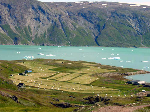
Kujataa is a subarctic farming landscape located in the southern region of Greenland. It bears witness to the cultural histories of the Norse farmer-hunters who started arriving from Iceland in the 10th century and of the Inuit hunters and Inuit farming communities that developed from the end of the 18th century. Despite their differences, the two cultures, European Norse and Inuit, created a cultural landscape based on farming, grazing and marine mammal hunting. The landscape represents the earliest introduction of farming to the Arctic, and the Norse expansion of settlement beyond Europe.
About Igaliku
Igaliku is a settlement in the Kujalleq municipality in southern Greenland. The town was founded as Igaliko in 1783 by the trader and colonial administrator Anders Olsen and his Greenlandic wife, Tuperna. In 2020, Igaliku had 21 inhabitants. The nearby Norse ruins of Garðar and the farms surrounding the town were inscribed on the UNESCO World Heritage List in 2017 as part of the Kujataa Greenland: Norse and Inuit Farming at the Edge of the Ice Cap site.
Read more on WikipediaSelection Criteria
(v)
Details
- Countries
- Denmark
- ISO Codes
- DK
- Coordinates
- 61.0017, -45.3747
Stay Nearby
Igaliku
Attractions & Tickets
Igaliku
Getting Here
Igaliku